Satellite Images Reveal Militia Role in Burning Farmers’ Crops in Darfur
carried out by the Rapid Support Forces using drones against farmers’ agricultural fields in Darfur as a “strategy of starvation.”
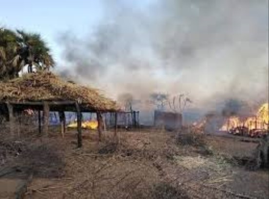
The newspaper published satellite images showing militia drones carrying out systematic attacks on farmland owned by farmers in North Darfur.
Experts cited by The Guardian said the aerial images collected from parts of Darfur could serve as evidence in international courts.
Based on satellite imagery and detailed technical analysis, the report said sensor data and satellite observations show that the militia’s attacks on agricultural communities were aimed at preventing villages from producing food.
Ammar Jad, a resident of villages in western Darfur, told the newspaper:
“The fields around us used to feed an entire area, then the militia men came and burned everything.”